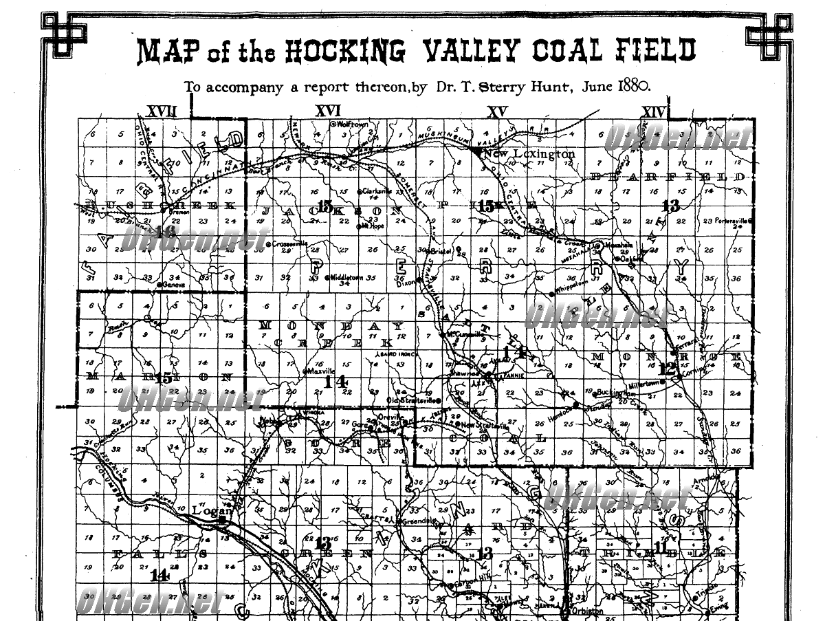
Map of the Hocking Valley Coal Field including the Iron Furnaces
Why did people come to the area of the Hocking Valley? They came to work for the iron furnaces, to drill oil wells, and to
work in the coal mines. Below is a map showing the railroads, towns and iron furnaces which drew the population to the
area. This map was created in 1880 by W. H. Jennings, an engineer for the Columbus and Hocking Valley Railroad.
I recommend using a magnifying glass to read the towns and info on this map. I use one while looking at the screen.
Below I will list the names of the furnaces I see on this map. Coal was used to fire these furnaces to cook pig iron into
smaller ingots that could be transported by train to other parts of the state. Also coal itself was in great demand and was
shipped all over Ohio. Before the mining of coal the iron furnaces were heated by charcoal which was made from
lumber from the trees cut down off the hillsides by men whose occupation was called colliers. This was very big business
between the years of 1870-1900 before a purer form of iron was found in the Great Lakes region. Some of the coal mines
continued in operation from 1900-1950's primarily for making heat and electricity. Later many of the mines shut down as it
was decided coal from the Hocking Valley region was too high in sulfur content and created to much pollution. Today an
effort is being made in the area to clean up the rivers, streams and lands where coal mining left its mark.
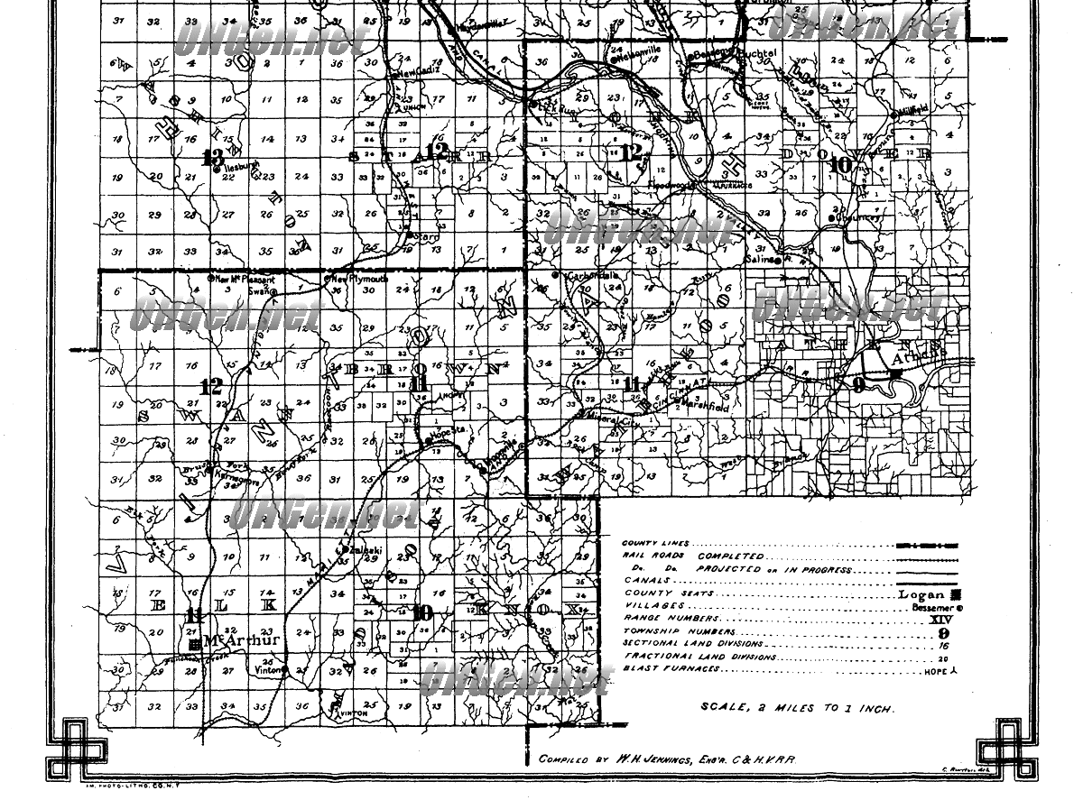
Furnaces listed on this map of 1880 are: The Vinton furnace in Elk township, Vinton county; there is the Hope furnace in Brown township in Vinton county it is just below the letter W in the enlarged word Brown; there is a Union furnace listed in Starr township Hocking county; there are two furnaces located side by side at Floodwood, York township in Athens county; there is the Akron Iron furnace located between Buchtel and Bessemer in York township in Athens county; there is the Helen furnace located in Orbiston which is on the border of Ward township, Hocking county and Trimble township Athens county; there is the Lee furnace located near Carbon Hill in Ward township, Hocking county; there is the Crafts furnace located near Greendale which is on the border of Green township, Hocking county and Ward township, Hocking county; there is the Wynona furnace located near Gore, in Gore township Hocking county; there is the Bessie furnace located near New and Old Straitsville in Perry county, Salt Lick township; there is the Fannie furnace and the E. E. furnace and a third furnace near Shawnee, Salt Lick township, Perry county; there is the Baird Iron Co. furnace in Monday Creek township, Perry county; there is a Moxahala furnace in Moxahala located in Pleasant township, Perry county. If anyone can see more furnaces on this map that I did not list please feel free to contact me.
The major railroads listed are the Columbus and Hocking Valley Railroad, the Marietta and Cincinnati Railroad, the West Virginia Railroad, the Somerset and Straitsville Railroad, the New York Railroad, the Cincinnati and Muskingum Valley Railroad, the Ohio Central Railroad.
Interested in saving the environment?
Check out the Monday Creek Restoration Project
http://www.mondaycreek.org/aboutmcrp.html
HTML created by Sandra Mitchell-Quinn
copyright 2002
ALL RIGHTS RESERVED